
Pick a destination.
Choose a place or a point on the map. Add stops to shape the ride you have in mind.
The quick way home or the longer way round. See your options, choose your route, and follow it on your phone.
See how it worksMaps and directions are a guide. Check conditions as you ride.
From an idea to a route
Choose a place or a point on the map. Add stops to shape the ride you have in mind.
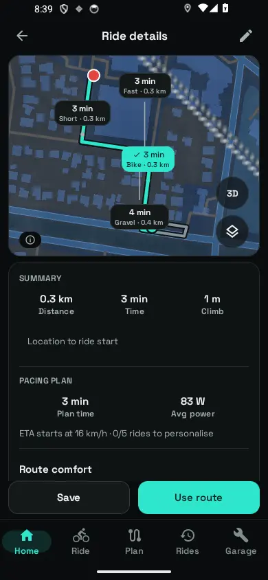
Compare route profiles, distance, climbing and estimated ride time.
Bring the route into your ride and keep the next turn in view.
Your route, your call
Fast, Short, Bike or Gravel. Compare what changes when you choose a different route profile.
This example shows the trade-offs. In the app, results depend on your destination, available routing data and settings.
Ride times are estimates. Weather, terrain, traffic and your pace can change the day.
Try a comparison Illustration · Example values
A time-focused option. Compare the distance and climbing before deciding.
Ahead of the signal
Prepare the area before heading out. Ride recording works offline; maps and route planning need the relevant downloads.
Fresh weather and online searches need a connection. Check your downloads before leaving.
Questions, answered
Yes, when the required routing data has already been downloaded. Download maps for the area as well. Offline place search needs its own place index; online search and fresh weather still need internet access.
You can import a route file or create a route from a saved ride. Imported tracks provide route geometry; do not assume they include the same turn instructions or surface information as a newly planned route.
Route planning can use a forecast to help estimate the ride. A forecast is not a guarantee of conditions, and new weather information requires a connection.
No routing service can guarantee that. Check signs, surface conditions and local access restrictions. Directions should never take priority over your judgement or the road in front of you.